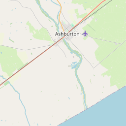
There are seven short formal trails and over 14km of track in Te Kuru that can be mixed and matched to create your perfect walk or bike ride.
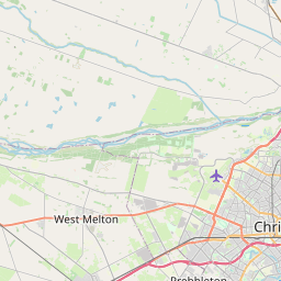
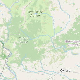
You will find map boards and wayfinding signs on site but feel free to download a map(external link) [PDF, 1.9 MB] or check the interactive map below.
Distance: 2.6 km
Time: 30 minutes
Dogs: Under effective control
Shared use: Yes
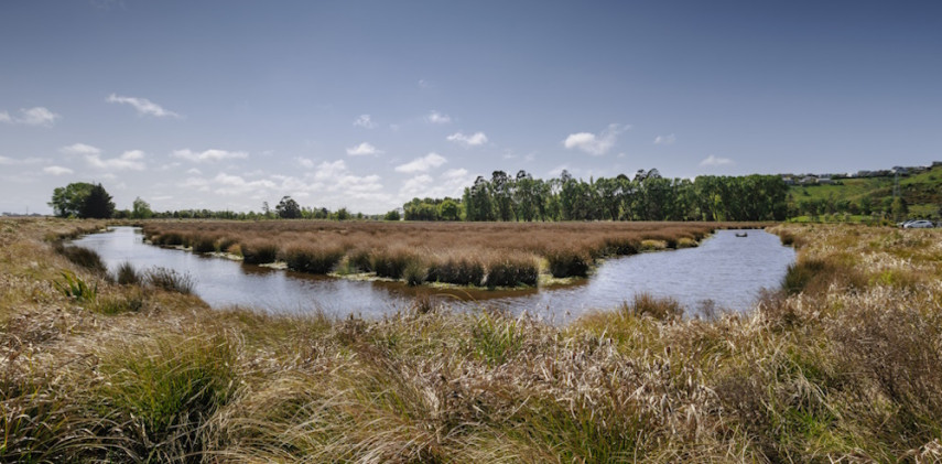
Description: The longest walk in Te Kuru, this track loops Sutherlands and Eastmans Wetland Basins passing many patches of forest planting. Look out for wetland birds such as poaka/pied stilt, warou/welcome swallow and pukeko. Combine this track with one or more of the others on site to create your ideal length walk.
Distance: 600 m
Time: 10 minutes
Dogs: Under effective control
Shared use: Yes
Description: This short trek passes through Milns Wetland Basins and numerous forest plantings. Look out for wetland birds such as poaka/pied stilt, warou/welcome swallow and pukeko.
Cashmere Stream Track East
Distance: 1 km
Time: 15 minutes
Dogs: Under effective control
Shared use: Yes
Description: This 1 km track follows the Cashmere Stream through the reserve and past native plants, rural landscape and ponds. You can lengthen the walk by following the stream all the way through Te Kuru to meet Cashmere Stream Track West.
Cashmere Stream Track West
Distance: 1 km
Time: 15 minutes
Dogs: Under effective control
Shared use: Yes
Description: A short 500 m track running alongside the Cashmere Stream. Enjoy bubbling springs and native plantings. Join up with Hoon Hay Basins Track and keep following the stream until you find Cashmere Stream Track East for a longer walk.
Sutherlands Basins Track
Distance: 1.2 km
Time: 15 minutes
Dogs: Under effective control
Shared use: Yes
Description: A longer 1.2 km track, this heads around the Sutherlands Wetland Basins, starting and finishing on Sutherlands Road.
Sutherlands Basins Loop Walk
Distance:600 m
Time: 10 minutes
Dogs: Under effective control
Shared use: Yes
Description: A short 600 m loop cutting Sutherlands Wetland Basin and first flush basin.
Hoon Hay Basins Track
Distance: 1 km
Time: 15 minutes
Dogs: Under effective control
Shared use: Yes
Description: Starting from the Cashmere Road car park this track follows wetland basins, ponds and native plants through the reserve where many other tracks branch off from it including Sutherlands Basins Loop Walk, both Cashmere Stream Tracks and Eastman Wetland Loop Walk. You can also join up with the Hoon Hay Basins Loop Walk to create a simple circuit back to the car park.
Hoon Hay Basins Loop Walk
Distance: 1 km
Time: 15 minutes
Dogs: Under effective control
Shared use: Yes
Description: Starting from the Cashmere Road car park this track follows wetland basins, ponds and native plants. Join up to Hoon Hay Basins Track or utilise some of the connecting paths to create a small or larger circuit walk.


10 km
Walking tracks
Shared use
Connecting tracks
Closed

Parking

Bus stop

Toilets
Water fountains
Accessible tracks

Challenging feature

Entry and exit point

Point of interest
Terms of Use | Feedback | Copyright information | Leaflet | Tiles OpenStreetMap, Data: Christchurch City Council
Walking tracks
Shared use
Connecting tracks
Closed
Parking
Bus stop
Toilets
Water fountains
Accessible tracks
Challenging feature
Entry and exit point
Point of interest
