
Information, data and tooling about our water supply, wastewater and stormwater assets.

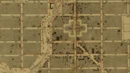
Take a walk through central Ōtautahi Christchurch and discover life in the city during the late 1800s.

More than 70km of cycleways make getting around way safer and easier for everyone.

Find out whether what you are doing is permitted or requires resource consent.

Information about coastal hazards and how these could change due to sea level rise.

Browse and download the latest compliance schedules.

Explore and learn what is being done to improve the health of our waterways.
Request, report and pay for Council services.
Apply for building and resource consents.
Manage your library borrowing.
Receive your rates invoice by email.
Book an indoor or outdoor space.
Take full control of your Rec and Sport membership.
List your events on What’s On Christchurch
Request, report and pay for Council services.
Apply for building and resource consents.
Manage your library borrowing.
Receive your rates invoice by email.
Book an indoor or outdoor space.
Take full control of your Rec and Sport membership.
List your events on What’s On Christchurch