The Council manages five closed cemeteries within Christchurch and the Banks Peninsula area.

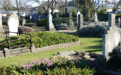
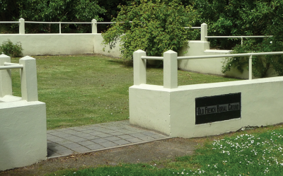
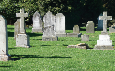
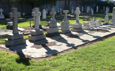
Addington Cemetery opened in 1858 and closed in 1980. The cemetery was in effect the city’s first public cemetery and its plots were taken up over a relatively short period of time. The cemetery is located on Selwyn Street (between Disraeli Street and Fairfield Avenue). View the Addington Cemetery map [PDF, 404 KB] or link to the plan on Canterbury Stories(external link) Addington Cemetery Conservation Plan [PDF, 3.6 MB] Appendix [PDF, 1.7 MB] The cemetery was established by the Presbyterian Church of St Andrews in reaction to the ‘exclusiveness’ of the Anglican Barbadoes Street Cemetery which was at that date the only cemetery in the city. As a public cemetery, Addington was open to all denominations with no segregation according to religion. The cemetery has a formal grid pattern of rows and graves head to head with a wide central gravel path which terminates at the original circular carriage turning area. The graves and paths are closely laid out not only because of the defined rectangular site but also because the Presbyterian Church had a requirement to make money from selling individual burial plots at the cemetery. Burials occur right up to the legal boundaries on the north and south sides and near the edge of Baxter’s Creek at the east end of the cemetery. The masonry styles are predominantly monumental Victorian style. There are a small number of elaborate sculptural monuments. The most common form of grave in the cemetery consists of a plain rectangular flat concrete slab on the ground, with an upright headstone. There are a number of established trees in the cemetery, particularly yew trees, however, early photographs show that the cemetery had very little vegetation. Recent Oak, Beech and Sycamore trees have aesthetic value and as plant types are appropriate for a Victorian cemetery, however, they are recent and are not significant. Many are intrusive and root growth is damaging the heritage fabric. Profits made from the purchasing of plots went towards the acquisition of sites for religious and educational purposes and also to relief of the poor and provision of bursaries for the Christchurch High School (today known as Hagley Community College). The first burial took place in November 1858. The deceased was George McIlraith, brother of Jane Deans who died at age 20. Burials continued in the cemetery up to 1980 with only a few burials and interments of ashes since then. Ownership of the cemetery was transferred to the Christchurch City Council in 1947 who have maintained the cemetery as one of the city's recognised 'green spaces'. Noteworthy people buried here include activist Kate Sheppard, Christchurch Mayor Tommy Taylor, artist John Gibb, architect Samuel Farr and members of the pioneer family, the Deans. Find this and other heritage points of interest on our heritage map. The Cimetière Catholiques or French Cemetery as it came to be known is the oldest consecrated European cemetery in the South Island. It opened in 1840 and is now closed. As part of the 50th anniversary of the constitution of the Akaroa Borough, the cemetery was given a total facelift. Funded by the War Graves Commission, all existing plant fabric and remnant grave material was cleared from the grounds. Bodies were reburied in a central plot and two coffin inscription plates were salvaged and included as memorial fabric mounted on a central memorial. The central memorial feature lists the names of those known to be buried on L’Aube Hill as far as it was possible to ascertain. The cemetery was the first in Akaroa and therefore would have had both French and English burials until the Akaroa Anglican Cemetery and Akaroa Dissenters Cemetery were opened at the opposite end of the Akaroa settlement. Early descriptions of the original cemetery landscape indicate that it was originally hedged with Gorse, Ornamental Willow trees and Roses. Find this and other heritage points of interest on our heritage map. Barbadoes Street Cemetery opened in 1851 and closed in 1885. It is the city’s oldest cemetery and final resting place of many of Christchurch's early citizens. Barbadoes Street Cemetery Conservation Plan [PDF, 12 MB] The cemetery is a cultural heritage landscape made up of three original, denominationally distinct cemeteries. The two lanes of one-way Barbadoes Street separate the former Roman Catholic and Dissenters Cemeteries on the west from the Church of England Cemetery on the east. Despite this significant physical separation, there is a strong visual connection between the east and west cemetery landscapes, reinforced by their shared landscape character. The history of the cemetery reflects the history of early Christchurch. The stories of its beginnings and the people buried there paint a rich and varied panorama of the life lived in the nineteenth century and into the last century. In the years after the cemeteries were closed, desecration and vandalism in the grounds increased. The history of the cemetery through most of the twentieth century was mainly one of neglect and vandalism. Community initiatives over the years have improved the cemetery and in recent years the general maintenance of the cemetery has been orientated towards order and passive amenity. The Sexton’s House on the Cambridge Terrace frontage of the former Church Of England Cemetery is the only surviving historic building associated with the use and management of the cemetery. The present house was built in the 1920s replacing an earlier cottage on the same site. Previously there was also a Mortuary Chapel, which was demolished in 1955, and a Lychgate. The cemetery contains a mix of remnant ornamental tree species and introduced indigenous and exotic plant species. There are four observable overlays of planting. Remnant vegetation from the establishment and operation of the original cemeteries before they were closed (1851–1885), closure and post-closure ‘sanitary planting strategies’ (1885–1890), 1950s exotic ornamentals—possibly influenced by the colonial revival landscape style popular in New Zealand in that decade, 1970s native species plantings and mid 1990s plantings. Please note: There are limited records for the Barbadoes Street Cemetery. Find this and other heritage points of interest on our heritage map. An interment site for the victims of the February 2011 Christchurch Earthquake is at the Avonhead Memorial Cemetery. The defined grassed circular area within the recent Avonhead Memorial Cemetery extension is dedicated to the interment site and provides a contemplative, restful area for families and visitors surrounded by established trees in a park-like setting. After considering all council cemeteries, Avonhead Memorial Cemetery was identified as the most appropriate due to its locality to the airport, available space, public transport and no liquefaction. The location of the cemetery site and the design concept were developed with close consideration given to the families of the unfound victims. The proposal was also developed in consultation with Christchurch Police and the Office of the Chief Coroner. The interment site is interdenominational and the design symbolises the Central City. The design of the interment site is intended to be simple and timeless, reflecting elements from the central city in a contemplative space. This area consists of ash beams for use by all victims of the earthquake and their immediate families. In some cases families may choose to install a headstone or plaque even if the victim has been or will be interred elsewhere. The beams are surrounded by white flower carpet roses (Rosa ‘Flower Carpet White’) and Yoshino Cherry (Prunus x yedoensis), a deciduous Japanese tree that flowers in early spring. Both species have been used elsewhere in the cemetery. The central feature is intended as a gift from the City to the four unfound victims and is the centrepiece of the design. It includes six granite plaques with the following text repeated in English, Filipino, Māori, Russian, Spanish and Braille. Etched in our City’s memory, never to be forgotten. The City of Christchurch Exposed aggregate paths flanked by Timaru bluestone entrance columns lead towards a Timaru bluestone plinth with a central Timaru bluestone feature. This area is reserved for the four unfound victims and their spouses or partners. Only one recumbent granite plaque per person may be attached to the existing bluestone recumbent. No immediate family (including children) maybe be interred in this plot. An ash plot can be prepurchased on the outer circle for immediate family members (children, parents, grandparents). Radiating out from the centre of the site is a stainless steel band identifying who the site is for. The band unifies the site in one location by encouraging someone entering from one of the four pathways to circle the site to read the text. The people of Christchurch will forever remember the unfound victims Radiating further out are four lawn segments with recessed Timaru bluestone beams. Each segment includes a seat where visitors can sit and contemplate. One of the four lawn segments is a burial area for the unidentified remains. This is marked by a granite plaque which reads: Interred here are unidentified remains recovered Two of the four segments are commemorative areas for the unfound victims. Each victim will have a granite plaque attached to the recessed beam. The four recessed Timaru bluestone beams are symbolic of the four avenues - Moorhouse Avenue, Rolleston Avenue, Bealey Avenue and Fitzgerald Avenue - surrounding the Central City of Christchurch which was severely damaged in the earthquake. The aggregate and Timaru bluestone plinth with a central Timaru bluestone feature is symbolic of Cathedral Square and the Cathedral itself. Timaru bluestone is found throughout the Port Hills area and the majority of heritage buildings in Christchurch were constructed using bluestone, which is quarried from Timaru. Exposed aggregate and Timaru bluestone elements used throughout the central city have been used in the design and are softened with simple plantings of white and red flower carpet roses (Rosa ‘Flower Carpet White’ and Rosa ‘Flower Carpet Red’) and standard ‘Loving Memory’ roses (Rosa ‘Loving Memory’ Standard). Species have been chosen to ensure the site is abundantly colourful throughout the summer and into February. Red tulips and snow drops will follow in late autumn/ spring. A hedge of Portugal Laurel (Prunus lusitanica) and Kobushi Magnolia (Magnolia kobus), a deciduous Japanese tree which flowers early spring, define the edge of the site and separate it from the wider cemetery area. Find this and other heritage points of interest on our heritage map. Mount Magdala Cemetery of the Good Shepherd Sisters is located in Halswell. The cemetery opened around 1888 and is now closed. Mount Magdala was the pioneering catholic social work institution for the care of women. The institution was established at Halswell between 1886 and 1888. The complex was founded as a predominantly self–sufficient community with a farmland orchard. Many residents were employed in laundry, sewing and cooking activities. By the 1930’s Mount Magdala was a self–contained community housing almost 500 people. Many new buildings were added over the years including a chapel in 1900 along with an orphanage in 1934. Of the many that passed through the institution, some were restored to their families and others were comfortably married or obtained situations. A relatively small number lived out their lives in the sisters’ care and were buried in the cemetery. Now placed at the head of the cemetery are the few permanent headstones erected. The wooden crosses that once marked the graves are now gone. Original cemetery plans and the memorial wall suggest that there are as many as 278 known graves from 1888 to 1972. The neighbouring Aidanfield Subdivision is named after Mother Aidan Phelan who is buried in the cemetery. Find this and other heritage points of interest on our heritage map. Rutherford Street Cemetery, also known as Woolston Cemetery is the second oldest cemetery in Christchurch. It opened in 1866 and is now closed. It is situated at the end of Rutherford Street, Woolston. View the Woolston Cemetery map [PDF, 455 KB] or link to the plan on Canterbury Stories(external link) The cemetery is located within an industrial area adjacent to a busy arterial road and factories. The cemetery can be regarded as both a separate cemetery and a churchyard, though it was some distance from St John's church itself. Originally maintained by St John's Church, the cemetery was taken over by the Council in 1983. The cemetery was established midway between three adjacent Anglican parishes – Opawa, Woolston and Heathcote. The latter two prior to their division were known as Lower Heathcote. The cemetery was administered jointly by these three parishes prior to it becoming the responsibility of the Council in 1983. A funeral chapel was located in the cemetery, it was designed by R.W England Junior and constructed in 1888. The chapel was relocated to Jubilee Home in 1949, and then relocated to its current home at the City Mission in 1991. The foundations of the chapel remain and a garden was established on the foundations. Arranged in the traditional monumental style of a late Victorian cemetery, the graves are laid out in a formal grid pattern. They are close together and are separated by narrow grass paths. Well established deciduous trees including many notable trees provide a pleasant enclosed woodland feel to the cemetery, however there are still views towards the Port Hills. Find this and other heritage points of interest on our heritage map.

 The cemetery is located on a flat terrace in the L’Aube Hill Reserve. From early photographs, it appears the cemetery had good views down to the township and the waterfront, which is very different to the enclosed feeling the cemetery has today surrounded by established trees and dense shrub vegetation. The layout of the original cemetery is now not visible and there are no remaining headstones as they were removed in the 1926 clean up
of the cemetery.
 The conservation plan was prepared by Opus international consultants to provide Council with tools to restore and maintain this important heritage cemetery for future generations.
 The site was opened to the public on Wednesday 22 February 2012 on the first anniversary of the earthquake. On 22 February a Memorial Service is held at the Earthquake Interment Site.
The design
The outer circle
The inner circle
 The establishment of the Good Shepherd Covent at Mount Magdala, Christchurch, dates from the early 1880’s. Today at Aidanfield, the historic Mount Magdala Cemetery and the St John of God Church are two remaining connections with the work of the Good Shepherd Sisters.

